
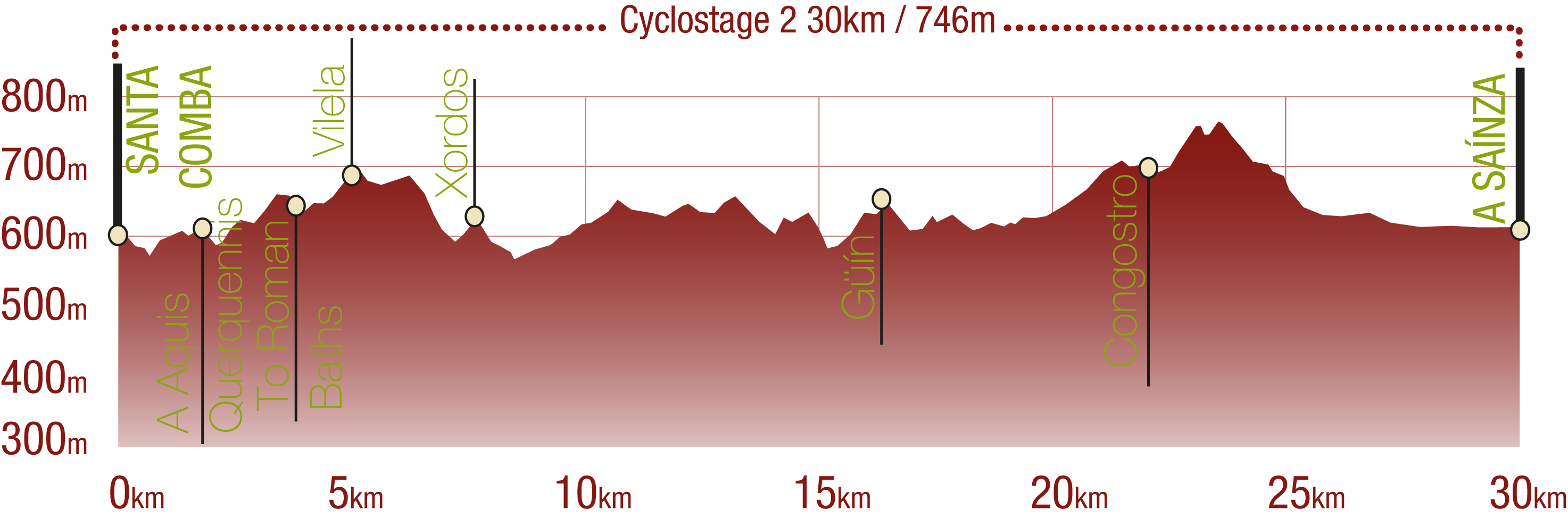
Section 2. Santa Comba de Bande - A Saínza
Description
From the Serra do Xurés to the the river Lima floodplain
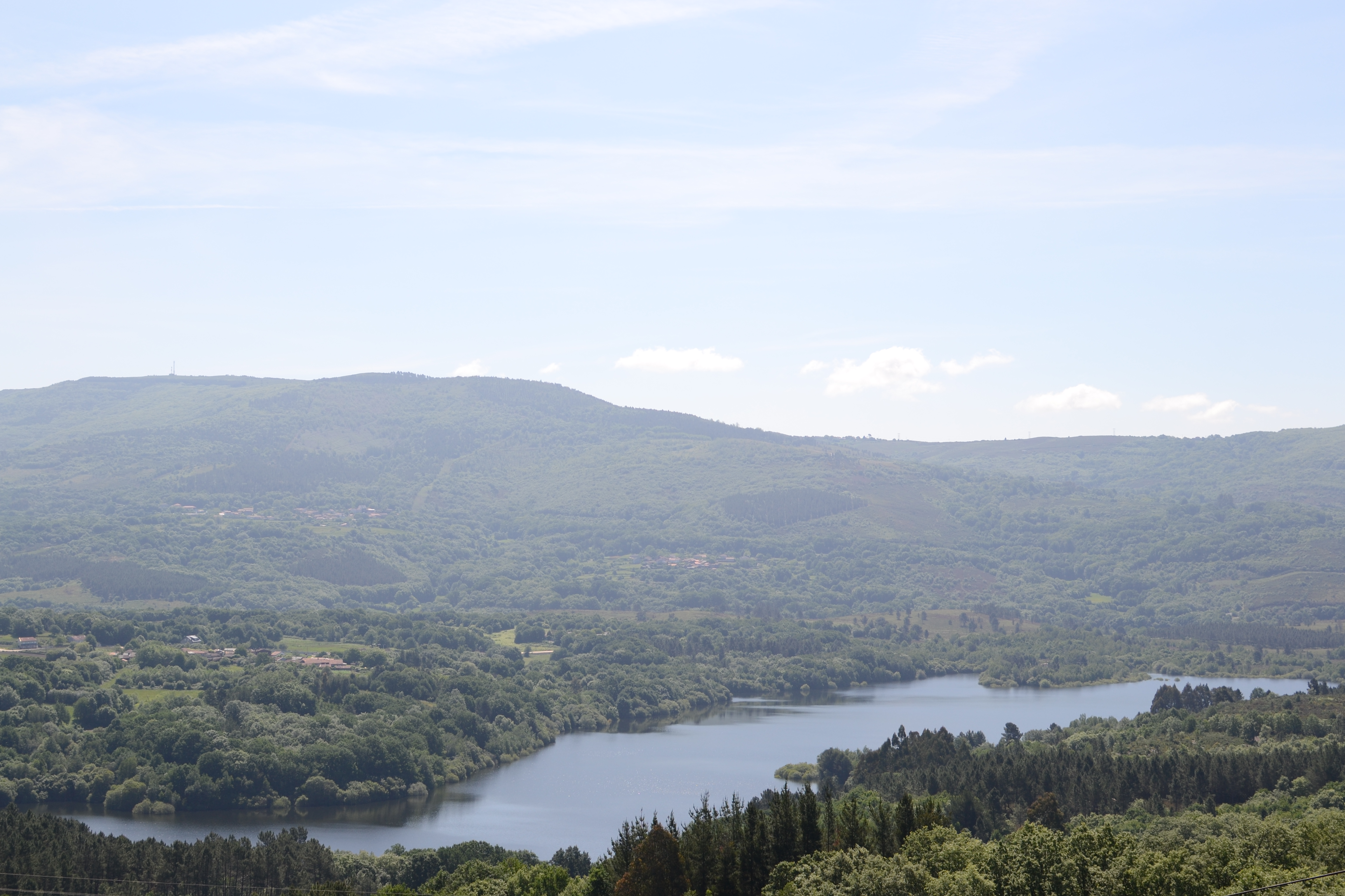
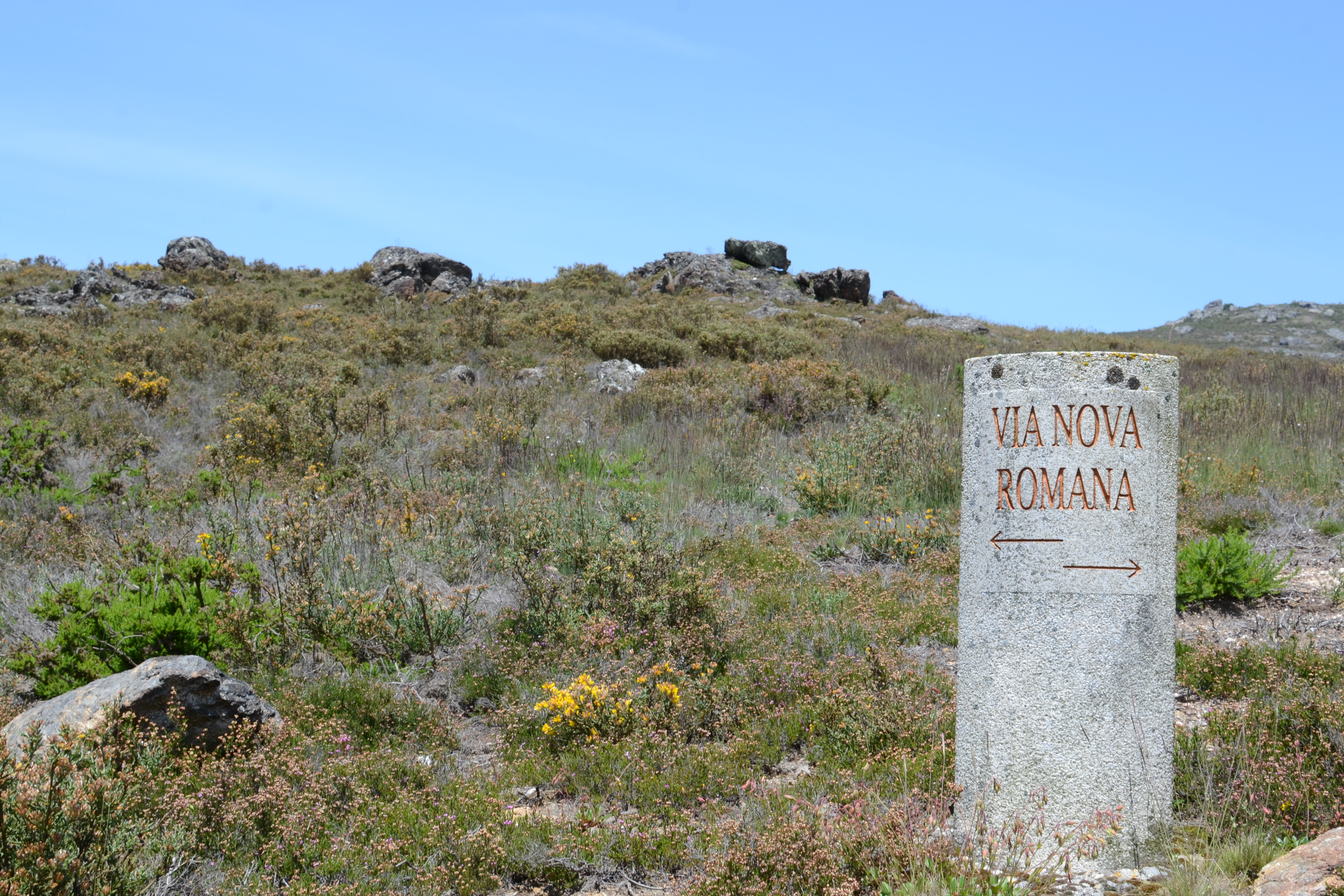
The second stretch of this nature trail is closely linked with the river Limia: at the reservoir of Las Conchas for the first few kilometres; then, surrounded by mountains and finally, from A Ponte Liñares, reaching a wide floodplain covered in crop fields. Much like the previous stretch ended, this trail continues traversing the villages of this region, where the traveller will discover the ethnographic richness of the La Baixa Limia and La Limia. Moreover, Roman remains linked to the Via Nova will appear frequently, with a fork through which the traveller can visit the archaeological site Aquis Querquennis and its interpretation centre.
The second stretch of the Vía Nova Nature Trail starts at a car park on the outskirts of Santa Comba, next to its church and cemetery, and shares its path during 6 km with the Santa Comba-Celanova stretch of the San Rosendo Nature Trail.
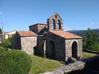
Shortly after entering the village through a broad street, the trail reaches the Visigoth church of Santa Comba de Bande, a National Monument and a Heritage of Cultural Interest considered as one of the architectonic jewels of the Iberian Peninsula.
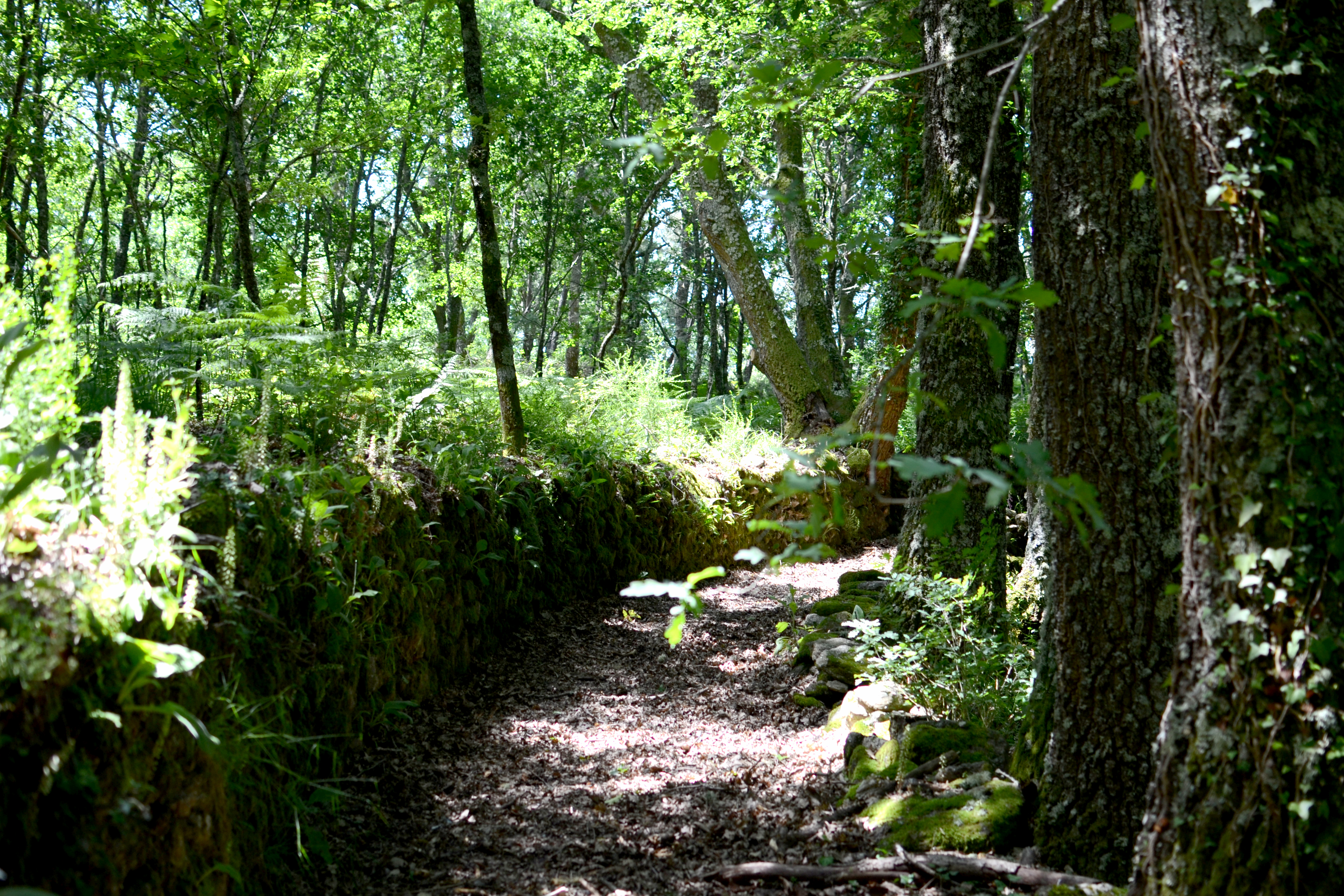
The first kilometres of this stretch, just like the lasts kilometres of the preceding section, follow a similar trail, using narrow rural routes that connect the villages, squeezed in between masonry walls and escorted by trees creating a thick cover. The trail passes by Santa Comba, Quintela, Lobosandaus and Vilela.
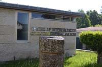
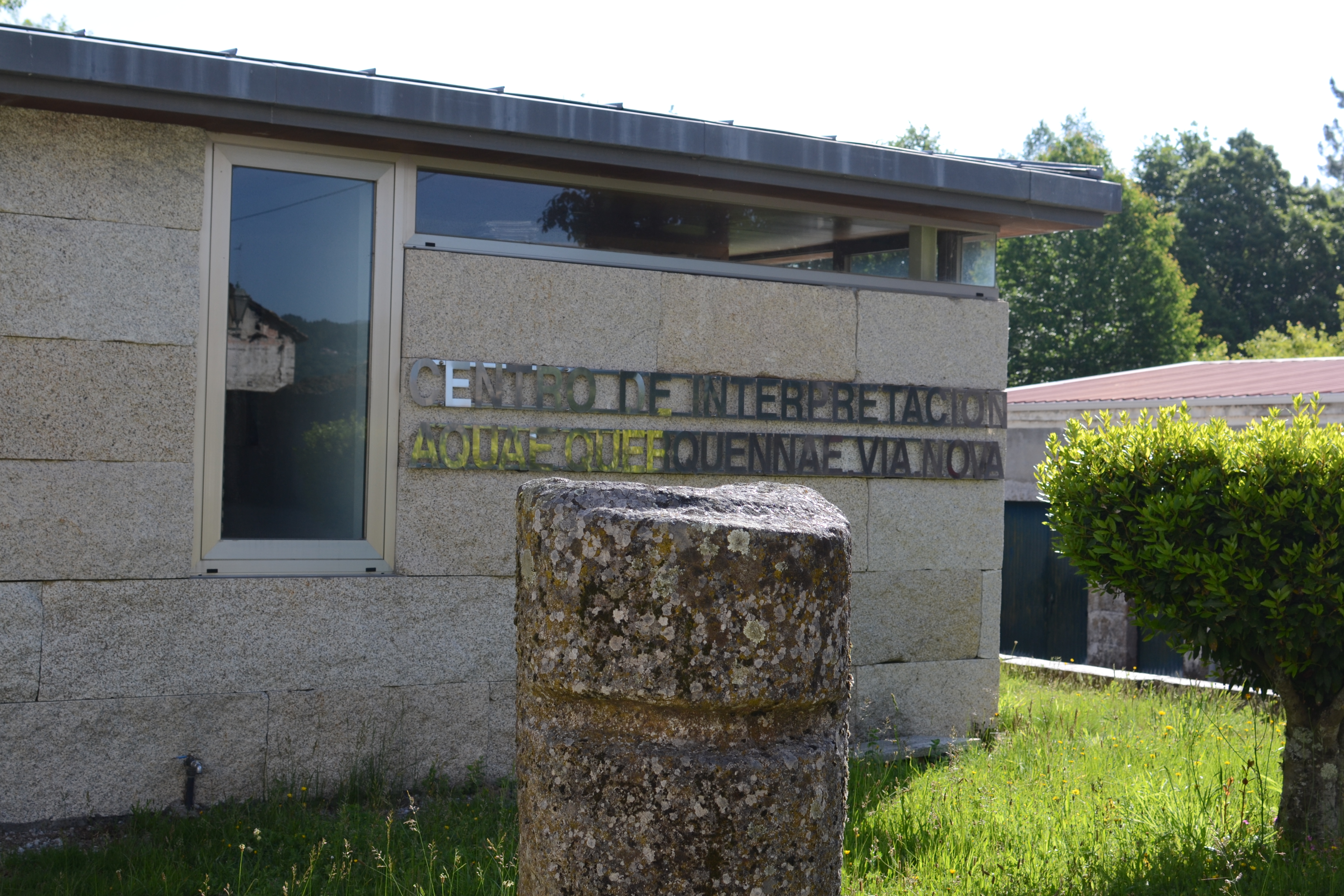
In Quintela, the traveller can take a circular detour of one and a half kilometres that passes by the archaeological site Aquis Querquennis, the remains of a Roman military camp which was probably used by the cohort responsible for monitoring the Via Nova. Even though the access to the site depends on the state of the reservoir of Las Conchas, as high waters completely cover it, the interpretation centre is worth a visit. This provides information about this site and about other discoveries in the area, about how life was in the Roman era, about the construction of the roads...
If the water levels in the reservoir are low, the route can be complemented with a visit to the nearby Aquis Querquennis mansio and to the Roman baths, where travellers can take a well-deserved dip before getting back on the trail. From the Roman bath, the Nature Trail can be resumed at Lobosandaus.
From Vilela, the trail starts climbing the slope of the mountain until reaching a pass where it is definitely separated from the San Rosendo Nature Trail. Afterwards, it descends a slope with few wooded areas until reaching an intersection with road OU-540. Travellers must proceed with utmost care at this point, since the intersection is not signposted and visibility is poor. After crossing the road, the trail continues to descend until the bridge of As Cabras, over the river Cados, which was probably built in the Middle Ages. This bridge is peculiar because each one of its arches has a different style: the central one is a semi-circle; one of the lateral arches is a Jack arch, and the remaining one is an ogival arch.
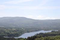
From the river, the trail starts climbing towards Xordos. However, it does not enter the village, but takes a detour to the right after passing by a restored mill and a panel. Nevertheless, it is interesting to roam the streets of the village and to visit the Xurés viewpoint, which offers magnificent views of the landscape that the trail passes through. From Xordos to Nigueroá, the trails narrows again surrounded by a thick forest of oak and chestnut trees and crosses a clearing where the traveller can sight the reservoir of Las Conchas before finally leaving it behind.
After crossing road OU-1201, the trail enters Nigueiroá through narrow streets until reaching its church, and then leaves this village by a paved road. Upon reaching a panel that explains the types of traditional trails, the trail leaves the paved road and follows a path among oaks and ferns that runs at mid-slope level.

This will be the landscape over the following kilometres of the route; the trail will only be paved when crossing a road or passing by Garabelos, O Ribeiro, Fervenza and Quintela. The trail does not enter Güín, the following village, but detours down a hillside towards the river Lima, next to one of the better identified stretches of the Roman road.
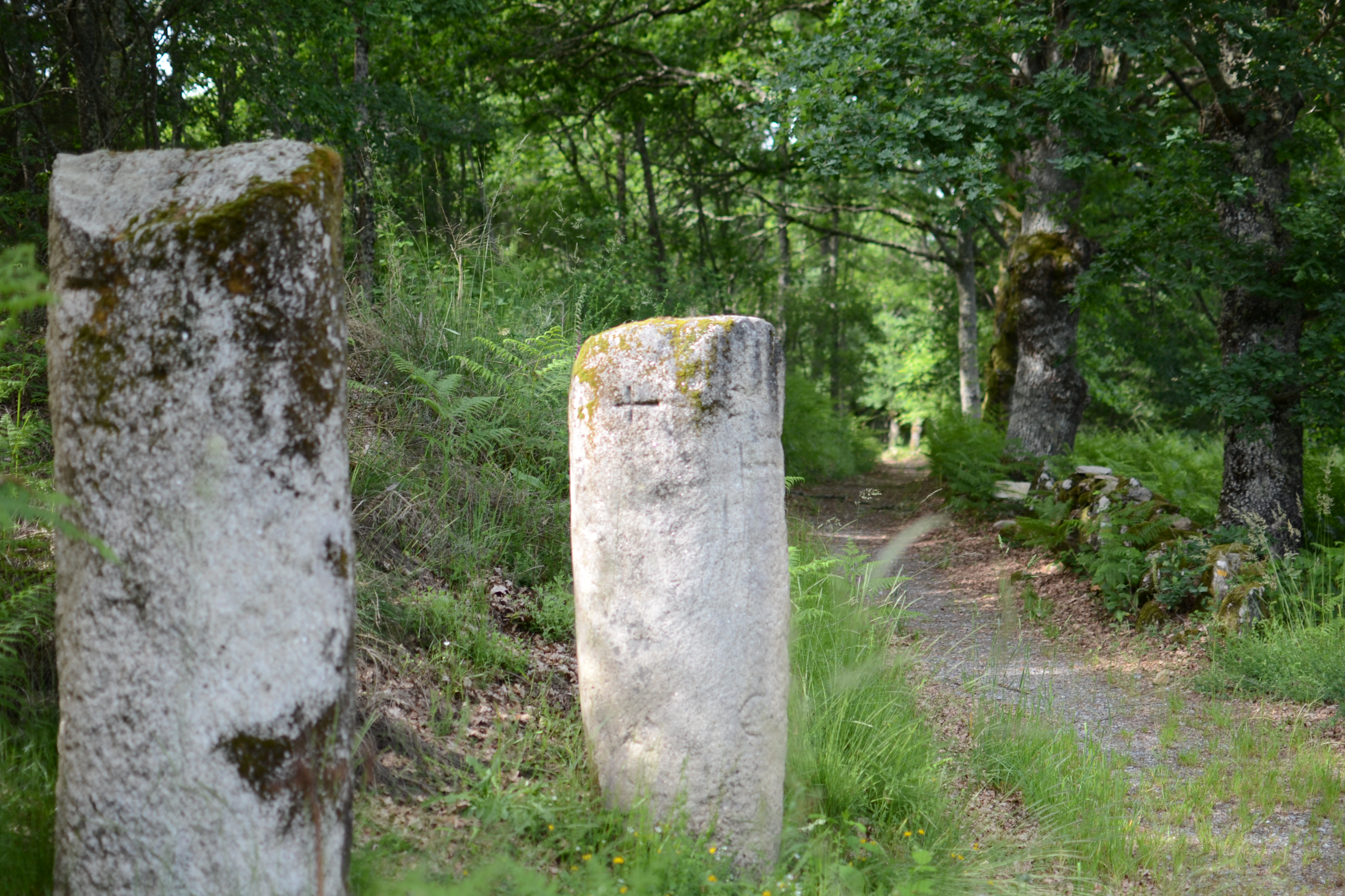
Arriving at O Ponte Liñares implies a radical change of the landscape, which turns from hillsides covered in vegetation to the river Lima floodplain, covered with crops. Nevertheless, after crossing road OU-301 and passing by the chapel of La Ascensión, the nature trail starts climbing the hillside escorted by oaks, and shortly after reaches the Roman milestones of O Padrón.

Along the trail towards Congostro, due to an area repopulated with fairly short pine trees, the traveller will be able to see the remains of the village of Antela on the other side of the river Limia. In the past, this area was more than three thousand hectares wide, but it was drained for farming and stockbreeding purposes. The stretches of water that can be seen nowadays are abandoned and flooded extraction sites.
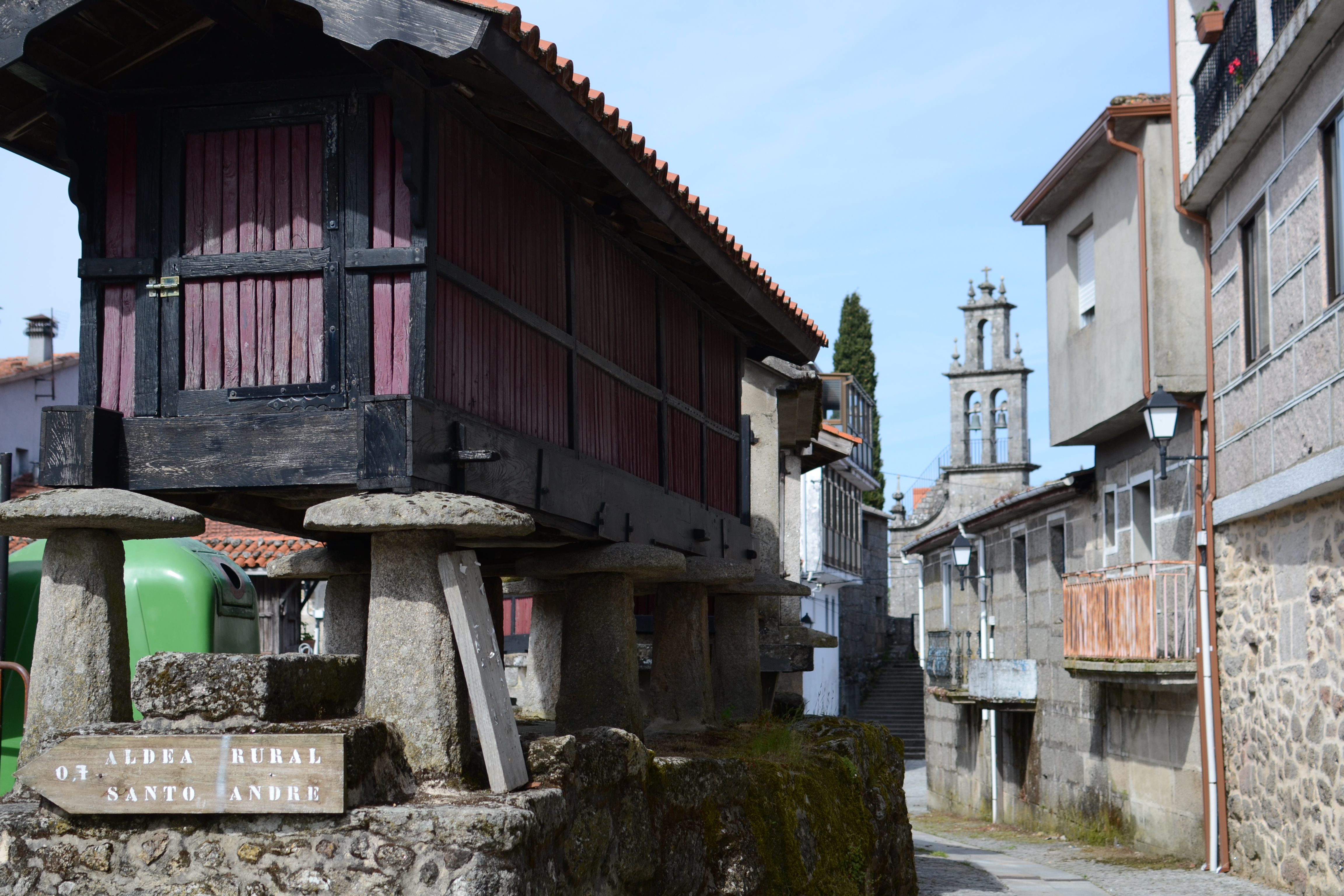
Congostro is a picturesque village which the traveller can discover while roaming its streets and its Plaza Mayor, surrounded by hórreos or elevated granaries. After crossing the village, the trail climbs a trench dug in the mountain and heads towards the village of San Miguel, which is virtually abandoned, passing by houses that have been rehabilitated to be used as a rural accommodation. From this village, the traveller can visit the castro of the same name. However, the trail actually continues between houses in ruins before entering the forest; the traveller must cross over a creek via a wooden walkway located next to an abandoned mill on the way to Penelas.
The following kilometres of the trail, between Penelas, A Rañoá and Carballal, are paved; the route deviates before reaching the village of Carballal. Back in rural trails separated from pastures and crops by a line of trees and scrublands and the typical masonry walls, the trail crosses the river Bidueiro (an affluent of the river Limia) before reaching the first houses of A Saínza, the end of the trail.
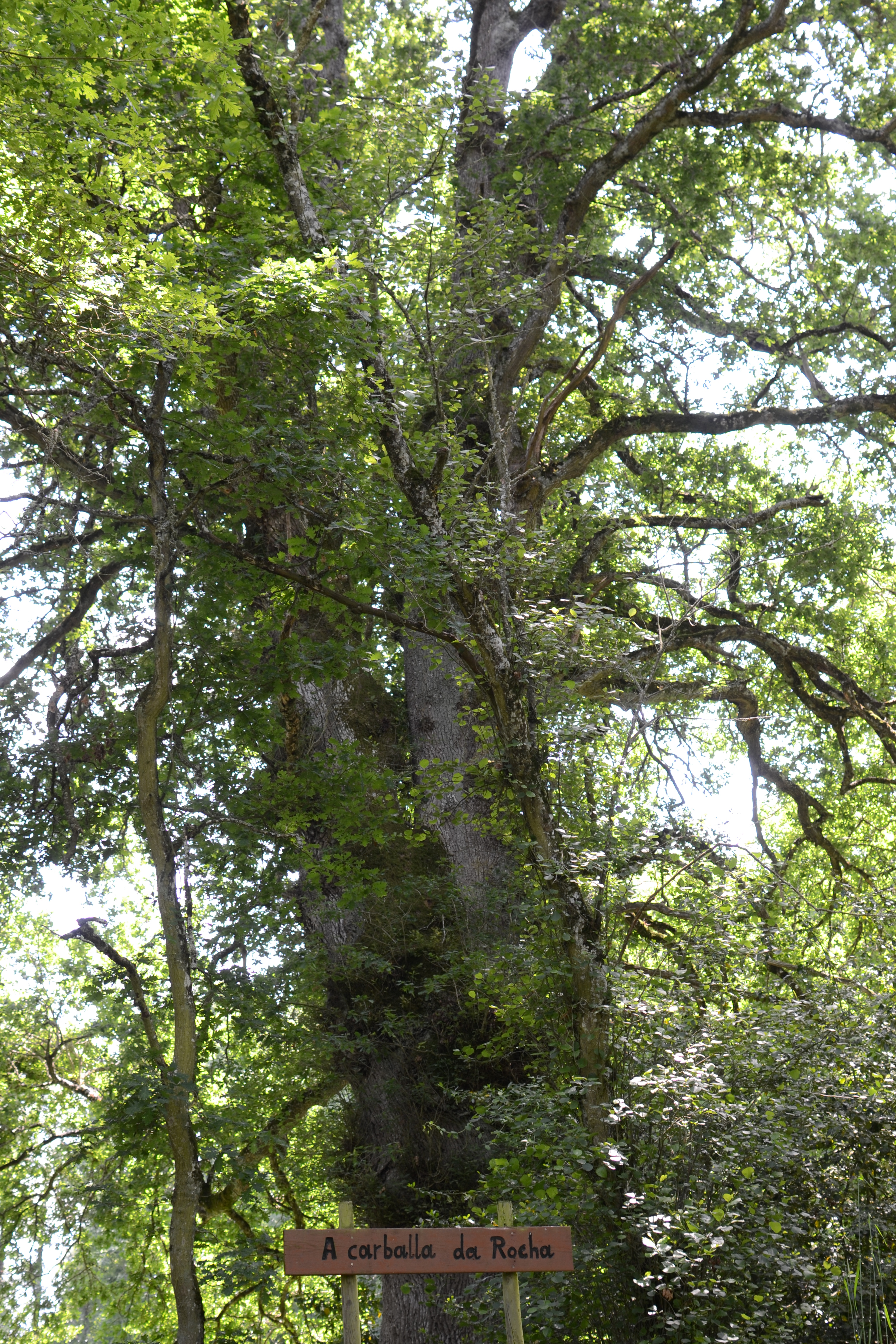
Before completely entering the village of Rairiz de Veiga, the traveller can admire Carballa da Rocha, a centuries-old oak that is over 30 m high and has a perimeter of almost 7 m (at 1.3 m high). This oak was declared a Natural Monument in 2007 and it is surrounded by other trees of the same species, which are also centennial but not as spectacular.
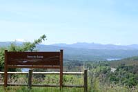
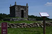
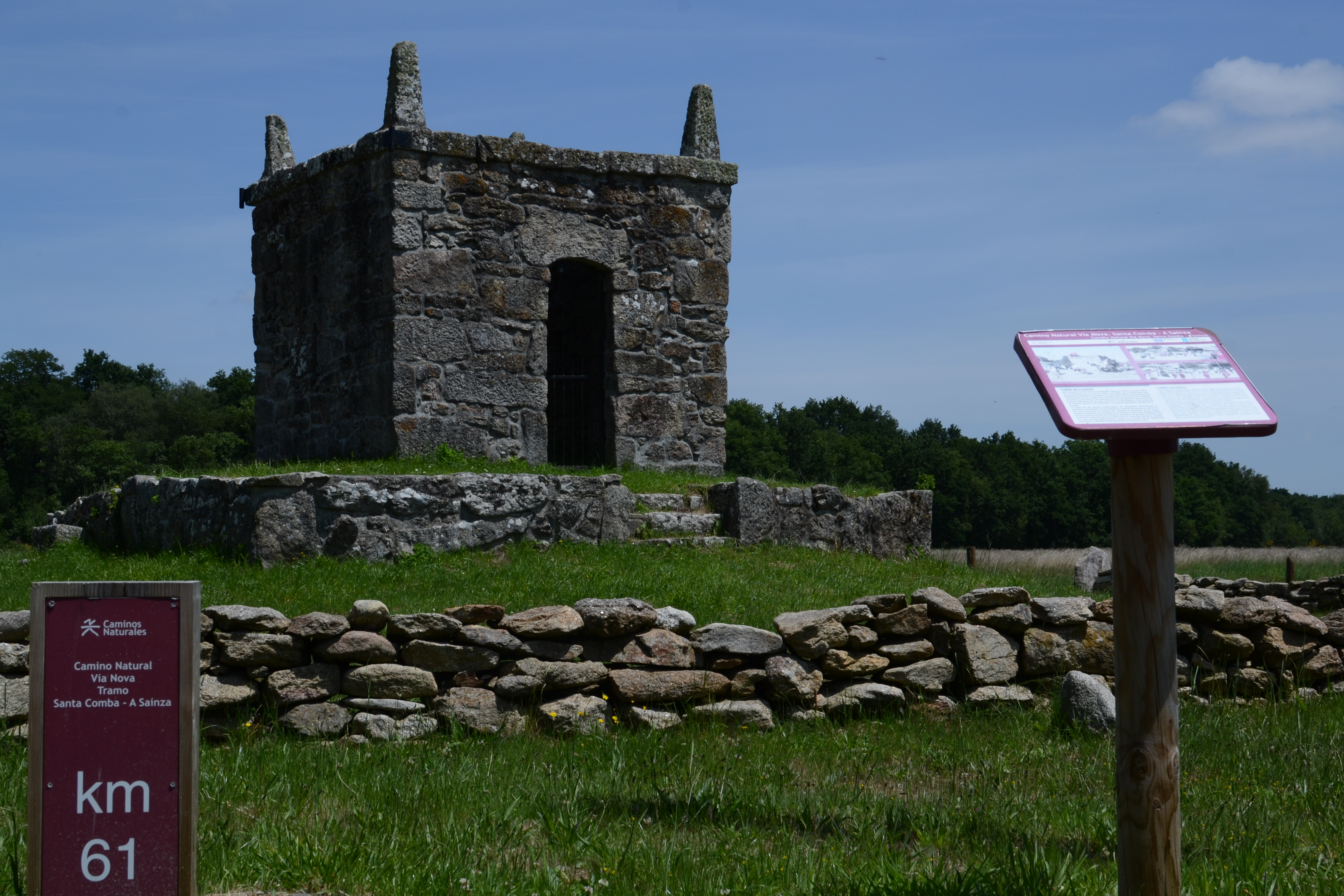
The last 500 m of the second stretch of the Vía Nova Nature Trail traverse the streets of the village. The trail ends next to a wide esplanade dominated by the tower of A Saínza, built in 1840 and declared as Heritage of Cultural Interest. It was constructed under the command of a priest after surviving a dangerous situation in Africa. A popular pilgrimage is celebrated on the esplanade every year, on the closest Sunday to 24th September, when people simulate a battle between Moors and Christians. This festivity, full of colours and with an assorted gastronomy, has been declared as Regional Touristic Interest.
Map
Puntos de Interés
Información
Infraestructura
Orografía
Vegetación
Profile
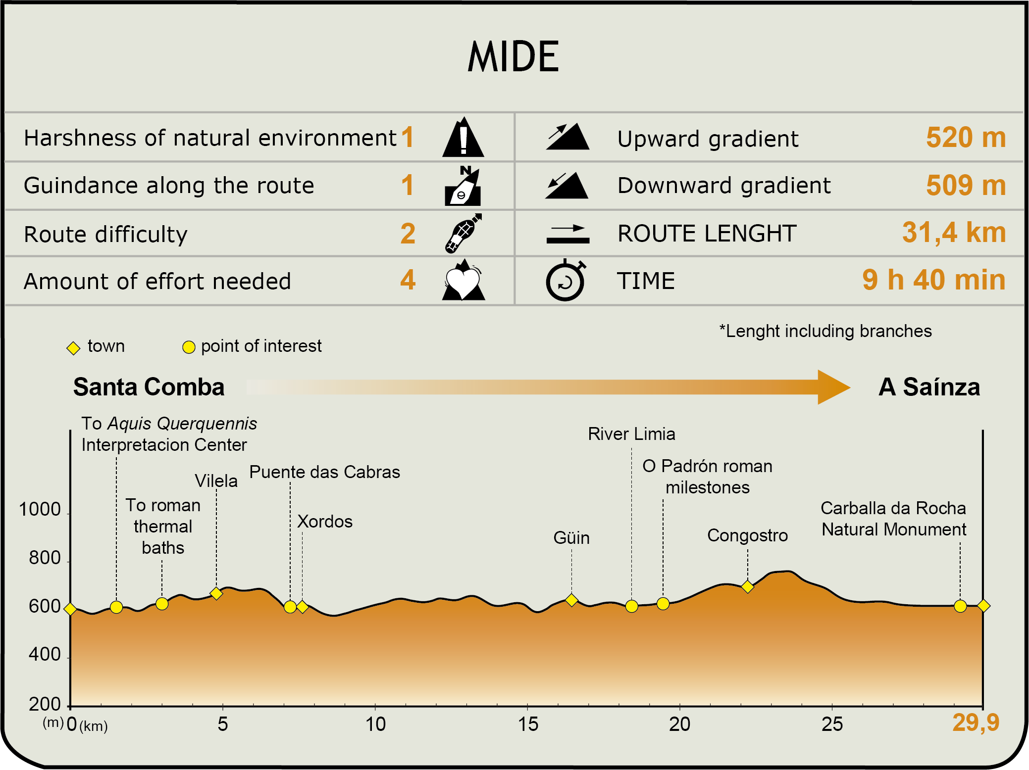
MIDE (Method for the Information of Excursions)
 Harshness of natural environment
- 1. The environment is not risk-free
- 2. There are more than one risk factors
- 3. There are various risk factors
- 4. There are quite a lot of risk factors
- 5. There are many risk factors
 Guidance along the route
- 1. Well defined trails and crossings
- 2. There is a clearly marked trail and signage
- 3. Requires the identification of geographic features and cardinal points
- 4. Requires off-path navigation
- 5. The trail is interrupted by obstacles that have to be gone around
 Route difficulty
- 1. Walking on a flat surface
- 2. Trails with different types of path
- 3. Walking on stepped paths or irregular terrain
- 4. The use of hands or jumping over the terrain is necessary
- 5. The use of hands is required to progress
 Amount of effort needed
- 1. Up to 1 hour of continuous walking
- 2. Between 1 and 3 hours of continuous walking
- 3. Between 3 and 6 hours of continuous walking
- 4. Between 6 and 10 hours of actual walking
- 5. More than 10 hours of continuous walking
Featured
Further information
Aquis Querquennis
This settlement was integrated in the Roman Lusitania (later known as the provincia Gaellacia), next to the via XVIII (or Via Nova) which connected Bracara Augusta (Braga) and Asturica Augusta (Astorga). The archaeological site has three excavations:
-The military camp: It was active between the 1st and 2nd centuries and was built at the same time that the Roman road. Apart from the walls, towers and moats, the barracks of the troops, the valetudinarium (hospital), a series of hórreos or elevated granaries (horrea) used to storage food and the principia or headquarters of the camp have been excavated.
-The mansio: small building with a big courtyard that was used as accommodation for travellers who used the via XVIII.
-Os Baños thermae: Even though more modern ones have been built, the original Roman baths can still be used.
The complex is complemented by the interpretation centre "Aquae Querquennae – Via Nova", which offers plenty of information about the archaeological site (with numerous excavated pieces and a recreation of the Roman camp) and also about the Roman life in the region.
Multimedia


Downloads
GPS Downloads
Cyclability
PROFILE
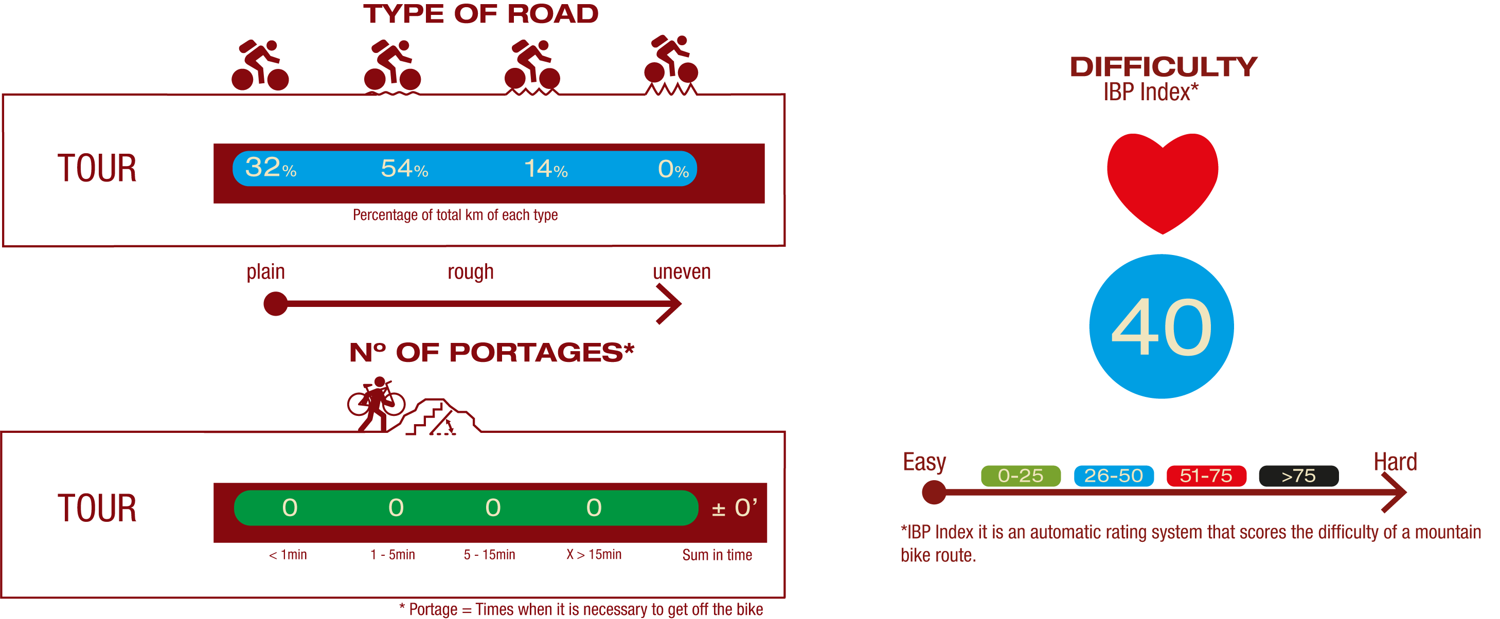
TYPE OF ROAD, PORTAGES & DIFFICULTY
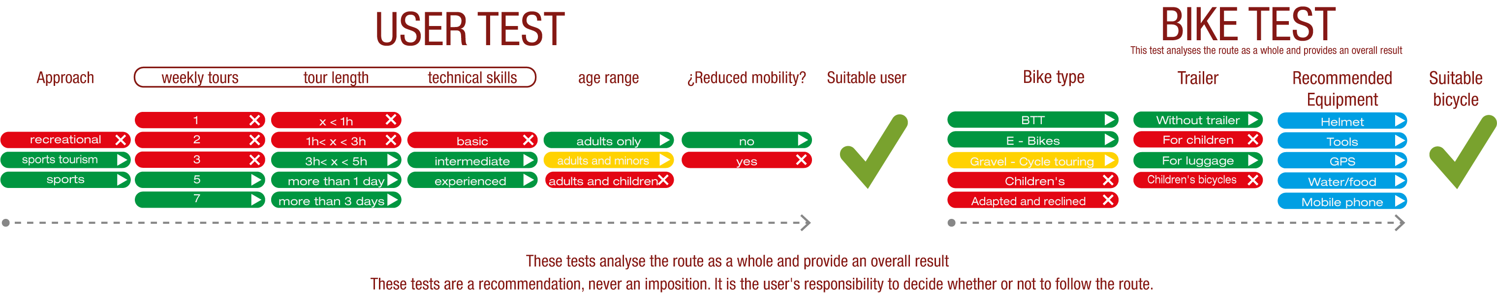
TEST
SAFETY RECOMMENDATIONS
- Sections shared with hikers.
- Transit through the centre of some population centres.
GENERAL RECOMMENDATIONS
- Find out about the technical aspects of the route and the weather on the day.
- Take care of the environment. Take care not to disturb animals or damage vegetation. Respect private areas.
- You must give priority to pedestrians and comply with general traffic rules.
- The environment in which you will be riding is open, free to move around and an area where many activities are carried out (sporting, forestry, livestock and agricultural activities). Always have an understanding, prudent, responsible and respectful attitude.